SPRING
The Shimanami Kaido Journey Part 1: Bridges, Islands, and Ramen
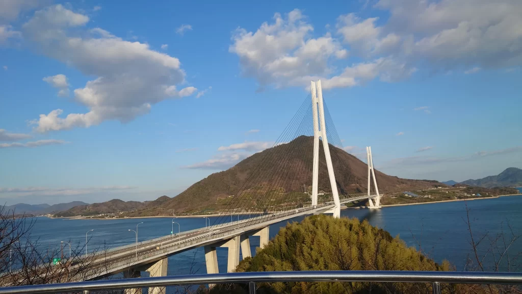
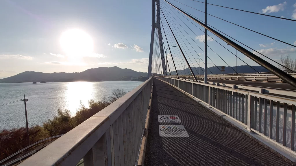
Kurushima Kaikyo Bridge, 2024
If Mount Fuji is the mountain to climb in Japan, then the Shimanami Kaido is the route to cycle. From end (Hiroshima Prefecture in the north) to end (Ehime Prefecture in the south), it stretches 70 kilometers over six islands and across six uniquely designed suspension bridges. As one of the first National Cycling Routes to be designated in Japan, it truly is the ride to ride during your visit.
However, as with mountain climbing, timing is everything. In spring and autumn, the Shimanami Kaido is inundated with crowds eager to soak up the fresh greenery and fall colors, respectively. In summer, the entire area (known as the Seto Inland Sea) is a sweltering hell of nearly 40oC and daytime humidity between 70-85%. To avoid both the crowds and heatstroke, I elected to visit in winter, right around the first of the year.
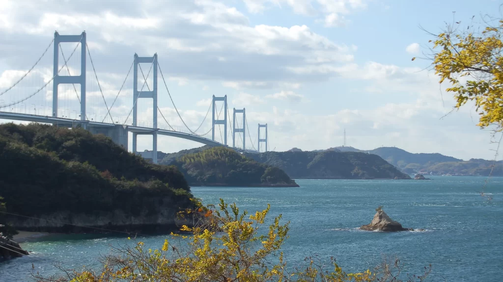
Tatara Bridge, 2022
There are two options for Shimanami Kaido riders: either ride from one end to the other and plan to stay overnight (if you’re using your own bicycle) or ride part way and then turn around so you can make it back before your chosen bicycle rental shop closes for the day. The disadvantage to either plan is that a lot for the “good stuff” is located toward the middle of the islands, so you’ll probably blow right by it in your rush to reach your hotel before you lose the daylight or you’ll have to turn your rental bike around before you get to see it.
What about buses and taxis, you wonder? Unfortunately, there aren’t any bicycle buses available. There are bicycle taxis, but you’ll need to reserve one in advance (and the cost may be a deal-breaker). Bicycle ferries are more economical. (More information on my favorite ferry option coming up!)
In my first attempt on this route in 2022, I decided to stay on an island about halfway along the route and split my cycling adventure up into two days. Starting in the middle from Omishima (Omi Island), I rode south to Imabari Train Station and back for a total of 80 km. On the second day, I rode north (30 km) to Onomichi City and elected to take a ferry on the return trip, which covered a distance of 25 km and left only 5 km to ride back to my accommodations.
I was exhausted.
Bragging rights (and my incorrigible curiosity to see all that a route has to offer) aside, I found myself not enjoying several portions of my journey, so when I returned this year for another attempt, I focused on enjoyment over stubborn brute pedal smashing. Whether you’re bringing your own road bikes or are renting electric bicycles, here is one course that will put a smile on your face and keep it there!
Tatara Bridge, 2022
Central Course
Distance: 50 kilometers
Difficulty: Mostly flat with 1-km-long inclines of 3% to the bridges, other short hill climbs of 4%
Time: 5 hours (including a short lunch or coffee break)*
*Allow more time or shorten the course for mountain bikes and cross bikes
Start Point: Onomichi City, Hiroshima Prefecture, Honshu
Route: Onomichi Ekimae Ferry Terminal to Setoda Ferry Terminal – Island Explorer Route – Tatara Bridge – Omishima – Hakata Bridge – Sunset Beach – Return across Hakata Bridge – Island Explorer Route – Setoda Ferry Terminal – Bicycle Ferry to Onomichi
Let me talk you through it!
Take the bicycle ferry from the Ekimae Ferry Terminal in Onomichi, Hiroshima to Setoda on Ikuchijima (Ikuchi Island). The trip takes 45 minutes and costs 1300 yen per person plus 500 yen for a bicycle. (You can also look into bicycle rentals across from the ferry port in Setoda. It shouldn’t be difficult to find a bicycle to rent in the winter off-season.)
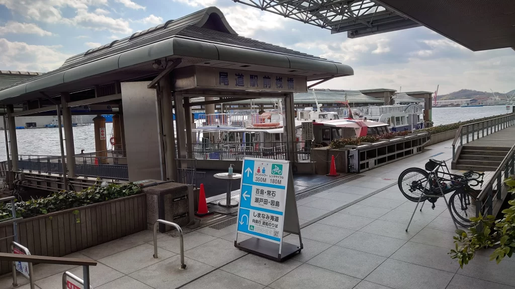
Onomichi Ferry Terminal to Ikuchijima, 2022
From the ferry port, turn left (northeast) and ride 6 km to the coast, then turn right (south). Ride on the left side of the road, alongside the flow of car traffic. Look for the blue line painted on the road which indicates an official cycling route, in this case, the Island Explorer Route.
At this point, you can do a circuit of the island (13 km in total) which will bring you back to the ferry terminal, or you can continue south toward the next island, following the Shimanami Kaido up to the Tatara Bridge.
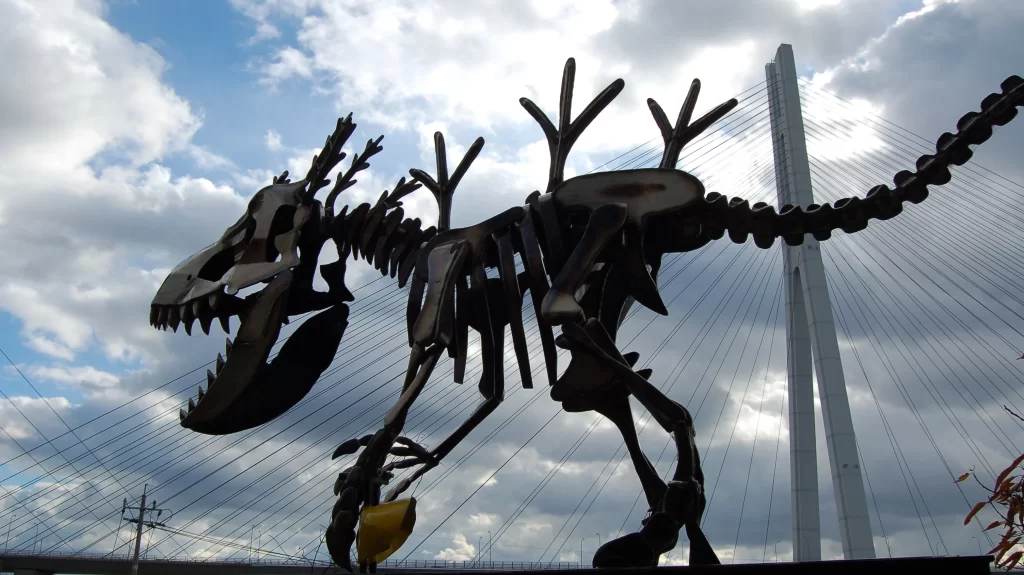
Sculpture on Ikuchijima, 2024
Cross the Tatara Bridge to Omishima. At the base of the bridge, there’s a Cyclists’ Sanctuary with a restaurant and souvenir shop that is worth a visit, even if you go just to hang your bicycle on one of the cleverly arranged figures.
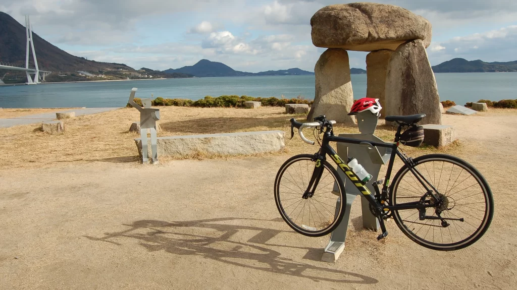
View from Cyclists’ Sanctuary on Omishima, 2024
Once you’re done with the view and documenting the awesomeness of your ride, follow the blue cycling route line south another 6 km to Hakatashima (Hakata Island).
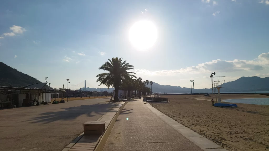
Sunset Beach on Hakatajima, 2022
After the bridge, your route will take you away from the ocean towards the interior of the island, but if you persevere, you’ll end up at Sunset Beach. While there, I recommend indulging in the salty ramen noodles made with fish stock. It’s called Hakatashima Ramen (not to be confused with Fukuoka City’s iconic Hakata Ramen) and is very difficult to find anywhere else along the Shimanami Kaido. So give it a try while you can!
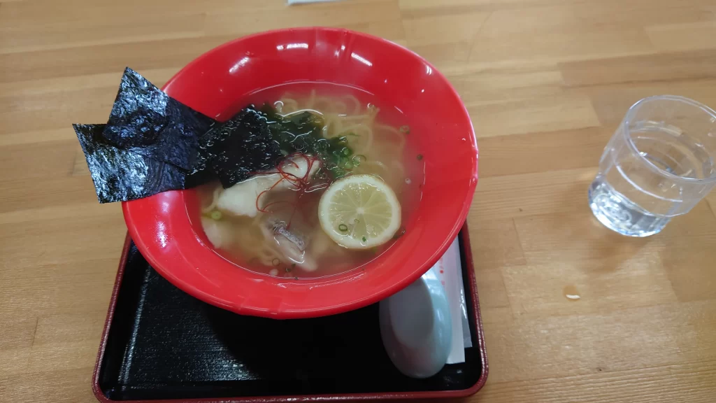
Hakatashima Ramen, 2022
From Sunset Beach, turn back and ride to Omishima then directly onward to Ikuchijima and the ferry terminal on the western side of the island. If you find yourself at loose ends before the ferry arrives to take you back to Onomichi, wander the streets. Shiomachi in particular is a nice walk with various shops, cafes, and lemonade stands along the way. There are also temples, shrines, and a 3-story hillside pagoda overlooking the straight to explore. (Don’t forget to pick up a pamphlet of Ikuchijima’s noteworthy spots from the ferry on the trip out.)
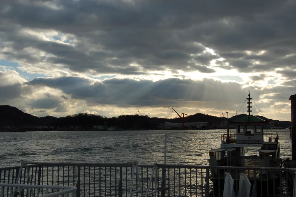
View from bicycle ferry at 4 p.m. in December, 2024
About Keri Yazawa
Keri Yazawa, a resident of Kanazawa City since 2005, guides bicycle tours specializing in good food, quirky history, local craft making, and gorgeous landscapes.
Article photos and written content © 2025 Keri Yazawa. All rights reserved.